

Slingshotted out of Dingle
An unforgettable (and slightly harrowing) morning drive through Ireland’s Wild Atlantic beauty.

We hadn’t factored in the 8:19 am sunrise in the far west of Ireland in late October when we decided to leave at 7:00 am to drive east, back to Waterford.
In the dark. In the rain. On a shockingly narrow road. Driving on the left. The headlights of oncoming traffic coming at us on the disconcerting right...
It was like something out of a video game... my Pat with two hands white knuckled on the steering wheel, careening around tight curve after tight curve, going about 20 km an hour faster than seemed prudent, to keep up with the local traffic...
I felt like I got a core workout just sitting in the passenger seat, every muscle in my body clenched.
“Well, we’ve successfully slingshotted out of Dingle,” Pat said once the sun started brightening the sky, the rain abated, the road widened and straightened out... and he allowed himself to stretch his fingers...
That was the stressful part... the rest of our Dingle adventure was a pleasure...
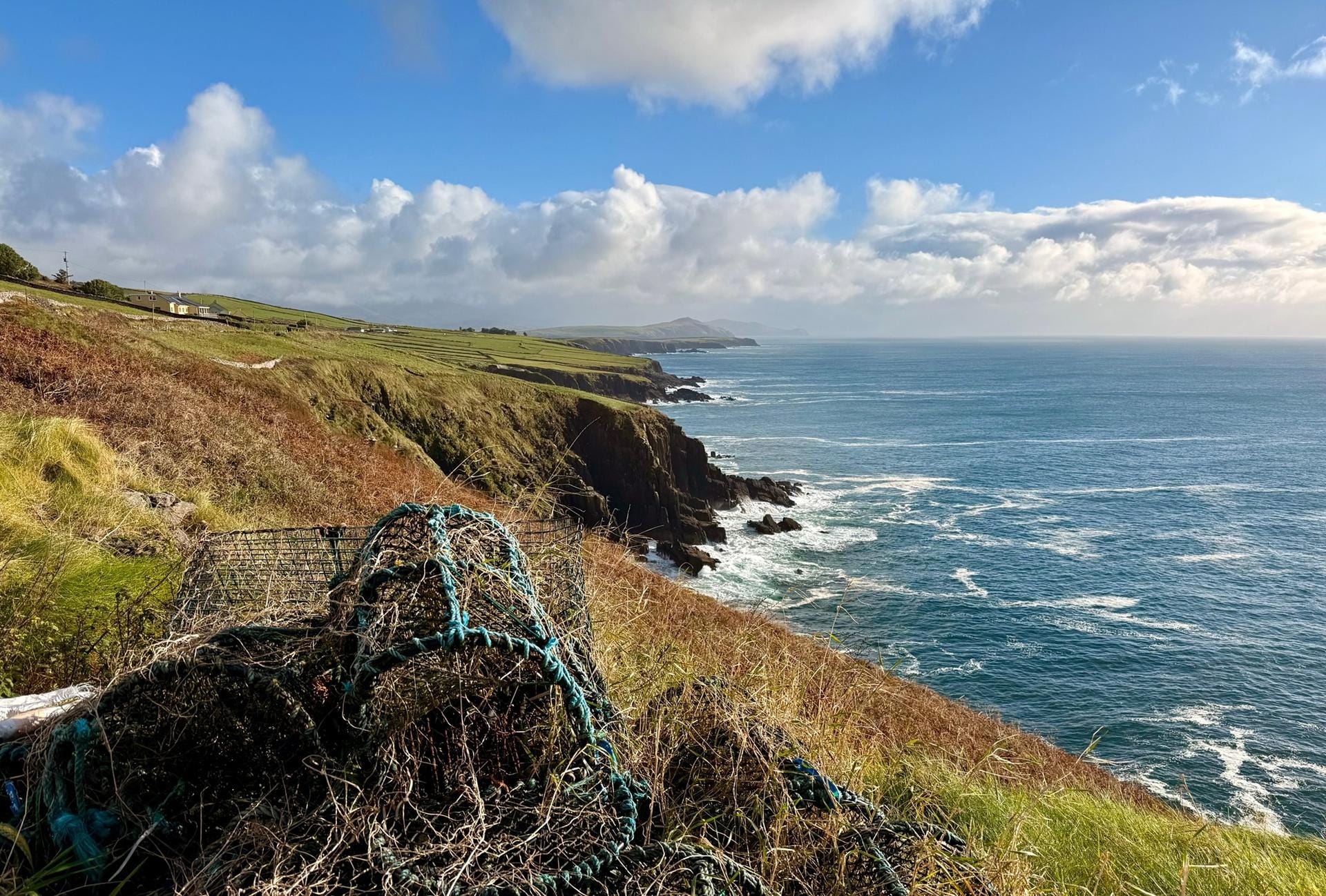
The Dingle Peninsula is just one small part of Ireland’s Wild Atlantic Way, a dramatic drive that includes the whole of the west coast.
From Dingle Town, you can spend a thoroughly satisfying day driving the peninsula—best done clockwise, the authorities say, with the coast to your left so as to avoid as much oncoming traffic as possible. And, too, best done at half the posted speed limit, stopping at the occasional pull-off to park the car and walk a bit and admire the views...
Along the way you’ll find “beehive huts,” which date to as far back as 800 AD. These ancient corbelled, stacked-stone ruins are built in increasingly concentric circles until the stones meet at the top to form a roof. The wind will be whipping as you climb up the hill to walk among the ancient stones and imagine how, 1,200 years ago, somebody else certainly stood where you stood, admiring the same dramatic view of a roiling sea.
We headed to the Great Blasket Centre, where the exhibits and movie provide a concrete sense for the trials of life at the far western edge of Europe, on the islands just offshore. You can see how, hunkered down against the wind and cold, poets and musicians are made. The Centre celebrates them and the traditional way of life that kept the Irish language and heritage alive on the islands.
Hard to believe that for so long the people here navigated these ferocious seas in simple row boats. These Irish are of seriously rugged stock.
We less-sturdy visitors required sustenance and stopped for a friendly lunch of fish and chips among locals at Kruger’s, billed as Europe’s most westerly pub. We marveled at what to us was the utterly incomprehensible Gaelic (or Irish, as the Irish say) being spoken at the next table over...
Properly sated, we piled back in the car for more Atlantic drama before a turn inland on a one-lane, hedge-lined road back to Dingle Town... and by one lane, I mean one single track on which a single car fits, though cars are, in fact, driving in two directions. You must have a keen eye for bail-out areas. A good thing the Irish are friendly.
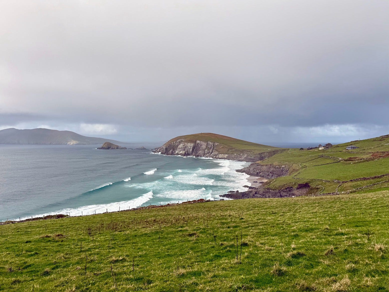
Along the coast before the turn, you can pull off and look out to Clogher Head, a promontory of land where puffins and cormorants flock and where parts of Star Wars VIII were filmed. Alas, we saw neither sea birds nor jedi in the distance... just a long, hilly stretch of land that felt like the end of the earth.
If you plan to visit, buy a paper map of Ireland—don’t rely purely on Google Maps. It’s good to have an old-school understanding of the lay of the land. (We bought one before we left and brought it with us.) The roads will be color-coded by relative size (something the Google Map won’t show you). Google will send you on the shortest path, no matter how charmingly dinky the road. I will say from experience: Unless you’re going but a short distance, you’re likely to want more asphalt to share. A paper map will help you find the bigger roadways.
You can take a bus to Dingle if driving isn’t your cup of tea. But even then, the map would be useful, just to better orient yourself.
On our way back to Waterford and Dublin, we stopped on the outskirts of Tralee to walk the ground where Pat’s people came from—poor farmers who sought a better life in America and boarded a ship in the late 19th century to find work on the railroads...
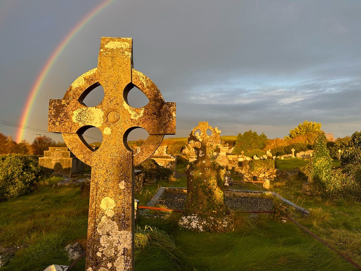
The script on the weathered headstones in the cemetery was unreadable, so we couldn’t say if any Aherns were buried there or not, though the ancestry research Pat had done indicated they most likely were.
Still, there was something oddly convivial about walking in the lane and through the field where his great grandparents had most likely walked... as the sun came through the clouds and a rainbow seemed to proffer a little bit of Irish luck...
— Jennifer Stevens, IL Executive Editor
P.S. If Ireland is on your mind, as it is ours, check out our new Passport to Ireland resource, an in-depth look at how to get an Irish passport... guidance on where and what to visit on this friendly, green island... how to stay legally for a few months or a few years... and lots more. We have a special offer on the table that saves you 50% right here.